
5 Lesser-Known Hikes 1 hour or less From Downtown Little Rock
Over the years, one of the few constants in my life has always been hiking. I love to get into the woods and away from screens and schedules and everything else for a while, as often as I can.
Some of the prettiest hiking trails in the world are in the Arkansas Ozarks, but I don’t often have the time to drive 2+ hours to them (one way). While Little Rock has some fantastic green spaces, most are geared towards jogging or cycling, and the ones that do offer actual foresty trails can be overrun on the weekends cough Pinnacle Mountain cough. I don’t know about you, but I prefer to get away from other people when I hike.
So, at the risk of inviting more folks to these areas, here is a list of 5 of my favorite lesser-known hiking spots within a one-hour drive of the River Market in downtown Little Rock. I can’t call them secret, exactly, but they are not well-trafficked by any means. These are places where you can really feel like you’re out in the woods, get a good hike in, and see no more than a handful of other people— even on a Saturday. Even better, they are all accessible by car, no 4WD required. (Of course, if you do visit any of these, you’ll be sure to be respectful and leave no trace… right?)
Distance from River Market: 47 miles (50 minute drive)
Trail mileage: 1.5 mile loop
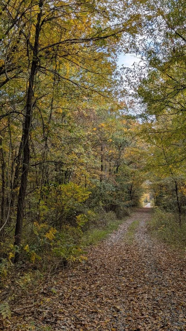
Cove Creek just barely qualifies for this list at 50 minutes from downtown Little Rock, but I had to include it because it’s just such a nice place to hike. The drive is quite pleasant once you’re off the interstate.
Take I-40 to Exit 124-A just past the Skyline exit in Conway, and head north on Highway 25/285. (Keep your eyes peeled as you approach Beaverfork Park on the right to see the oldest existing bridge in Arkansas, the Springfield-Des Arc Bridge, built in 1874 and moved to its current location in 2017.) Drive north about 12.5 miles, then take a left on Mallet Town Road. It’s gravel from here on out, but is usually in decent shape. Turn right at the Mallet Town Community Church, a cute little rock building, then go another 0.3 miles and take a right at the big red barn and cattle pen. (The first time I came here, I turned into someone’s driveway. The road you want is right after the driveway, marked on Google Maps as “Jd Rd.”) Once you’re on it, you should see a small white sign that says Cove Creek Natural Area. Park in the small gravel lot at the end of the road.
I like to follow the loop counterclockwise (and usually go around twice for the extra steps). From the parking lot, the trail winds downhill through the woods and over a small wet-weather stream before coming alongside its namesake Cove Creek. Cove Creek is a tributary of the better-known Cadron Creek, and boasts clear, mineral-rich water as pretty as any in the Ozarks. The trail climbs a gentle uphill grade until reaching a sweeping overlook of the surrounding hills and a bend in the creek below. From there, the trail stays mostly on the level as it winds back through a controlled burn area and back to the parking lot.
I recommend visiting in early spring, when the woodland ephemerals are blooming, the water is flowing, and the views aren’t too obscured by thick foliage. I have seen many lovely Arkansas native species here, including resurrection fern, downy serviceberry, red buckeye, fire pink, and one of my favorites, Dutchman’s breeches.
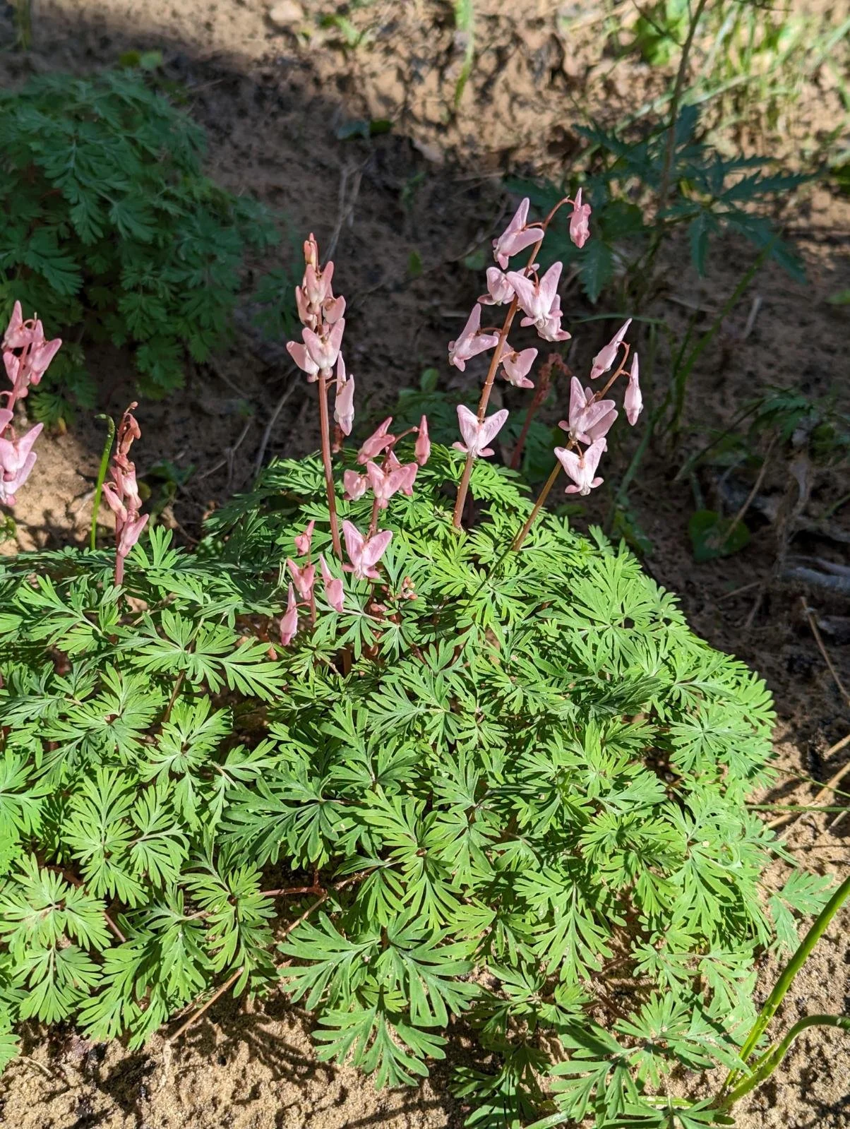
Dutchman’s breeches (Dicentra cucullaria), an Arkansas native (March 2023)
View of Cove Creek from overlook (March 2023)
Goat’s Beard Bluff Natural Area
Distance from River Market: 29 miles (35 minute drive)
Trail mileage: 2.7 mile out-and-back
This is a neat little hike right outside of Benton and easily accessible from I-30. (Unfortunately, you can hear the interstate from most of the trail, but if that doesn’t bother you, read on.)
The natural area encompasses over 500 acres and serves to protect at least 8 threatened native species, including the Arkansas fatmucket, a type of freshwater mussel. The area is named for a particularly rare wildflower called goat’s beard, and is supposedly the only spot in the Ouachita Mountains where it grows.
From downtown Little Rock, take I-30 south to Exit 116 toward South Street, then turn right on Highway 229. Drive about 1.4 miles and turn right on West Jackman Trail. Continue another 1.5 miles and park alongside the road (please don’t block the road or the gate).
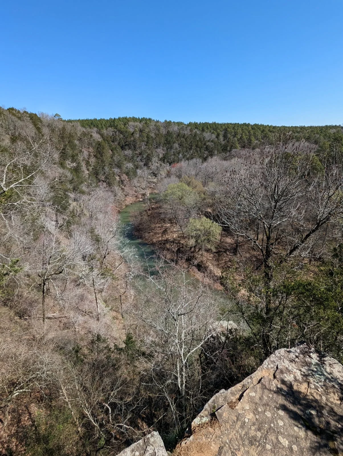
The trail starts at the yellow gate. It follows a Jeep road that does some up-and-downing through pine forest, passing through a few clearings and by an old farm structure. Eventually the trail ends at the bluff itself, affording a nice view of a long bend in the Alum Fork of the Saline River. You can’t see it from the overlook, but just downstream is a spot known to locals as Peeler Bend, an excellent summer swimming hole and canoe launch.
When you’re finished hiking, have a bite to eat at the Kream Kastle on Highway 70 outside of Lonsdale. You can thank me later.
Old roadbed trail through the pines (December 2025)
View of Alum Fork of the Saline River from Goat’s Beard Bluff (December 2025)
Bufflehead Bay, south shore of Lake Maumelle
Distance from River Market: 21 miles (30 minute drive)
Trail mileage: 2.3 mile loop
What began as a short paved spur along the lakeshore was finally completed in 2021 as a 2.3-mile loop trail that winds through some quintessential Ouachita Mountain scenery. Heading west from downtown Little Rock, the parking lot is on the right side of Highway 10, just past the turn off for Maumelle Harbor/Westrock Landing.
The first half-mile or so is flat and paved, interspersed with benches where you can sit and enjoy the Lake Maumelle waterfront. Towards the end of the flat section is a wooden platform for wildlife observation— it’s a great spot to watch for loons and other birds in the winter.
Continuing on, the trail swings away from the lake and heads up into the woods on a gentle uphill grade. It passes some interesting rock formations, typical of this area of the Ouachita Mountains, and switchbacks up to the top of a ridge. The trail works its way down through a prescribed burn area, past a pond, and back to the parking lot.
If you enjoy birding or want to squeeze in a few more steps, it can be fun to combine the nearby Farkleberry Trail with the Bufflehead Bay loop. It’s another mile west down Highway 10 and is quite short (less than half a mile), but very pretty as well.
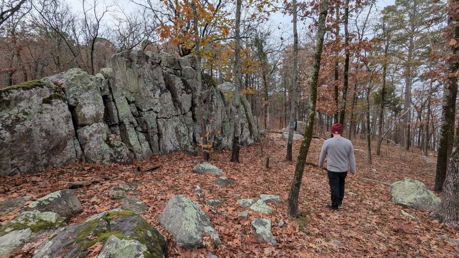
Ouachita rock formations along the Bufflehead Bay Trail (November 2025)
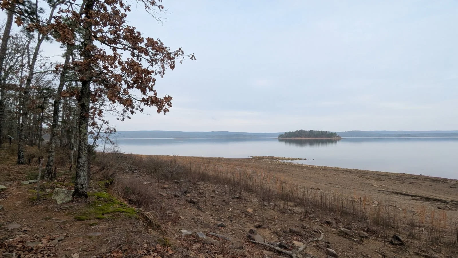
View of an island on Lake Maumelle from the Farkleberry Trail (November 2025)
William Kirsch Preserve (Ranch North Woods)
Distance from River Market: 14 miles (25 minute drive)
Trail mileage: Up to 3.5 miles
If you’re looking for a taste of Pinnacle Mountain State Park without the crowds, try the William Kirsch Preserve, tucked away behind the Ranch neighborhood in west Little Rock. It offers some beautiful views of the mountain, especially in leaf-off season. In addition to hiking trails, there is also infrastructure for mountain bikers and multiple boat launches for the Little Maumelle River, including one that has free loaner kayaks provided by the Nature Conservancy. It’s also a great birding location in the winter.
To get to the trailhead, take Highway 10 west from downtown Little Rock to the Pinnacle Valley area and take a right on Ranch Boulevard. Follow this road about 0.8 miles to a cul-de-sac, then take a slight left onto the gravel road, driving through an electric gate. Park in the gravel lot near the trailhead sign (don’t block the second gate, even if it’s closed).
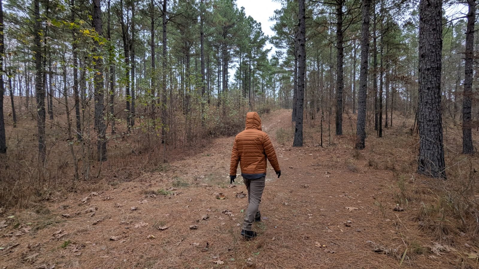
From the trailhead, cross the railroad tracks and head into the preserve. You have the option of choosing your own route from 3.5 miles of trails, which can be combined in a variety of different loops. I usually walk down the main service road to the wooded trail, follow it around to the kayak station, and then head back along one of the field trails. As of early 2026, multiple wooden bridges and raised boardwalks have been constructed on trail sections that abut the Little Maumelle, ostensibly to keep your feet dry when the water level is up. My favorite time to visit is late October, when the bald cypress and water tupelo’s foliage have turned orange, and yellow tickseed and goldenrod are still blooming.
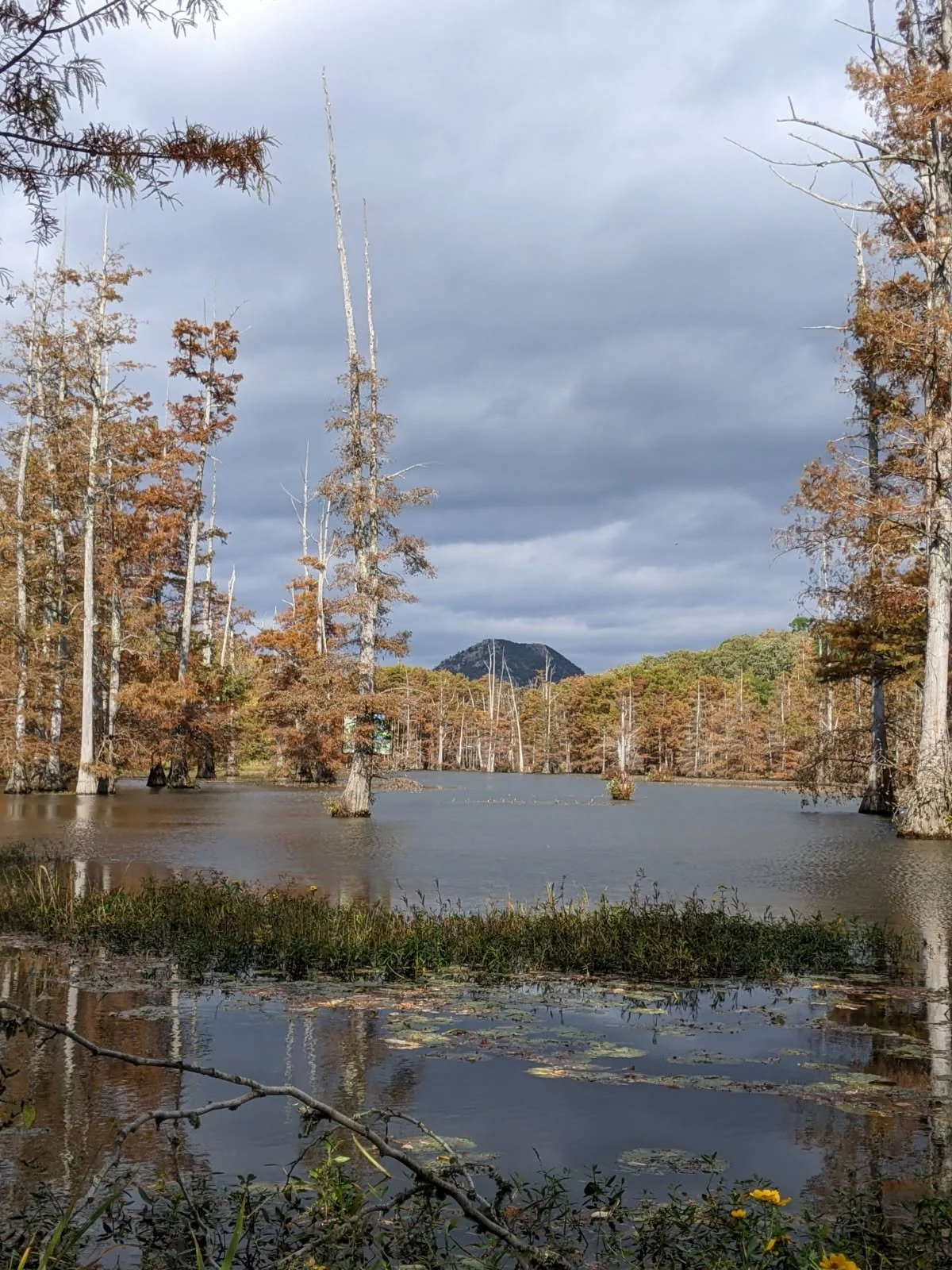
View of Pinnacle Mountain from the Little Maumelle River (October 2022)
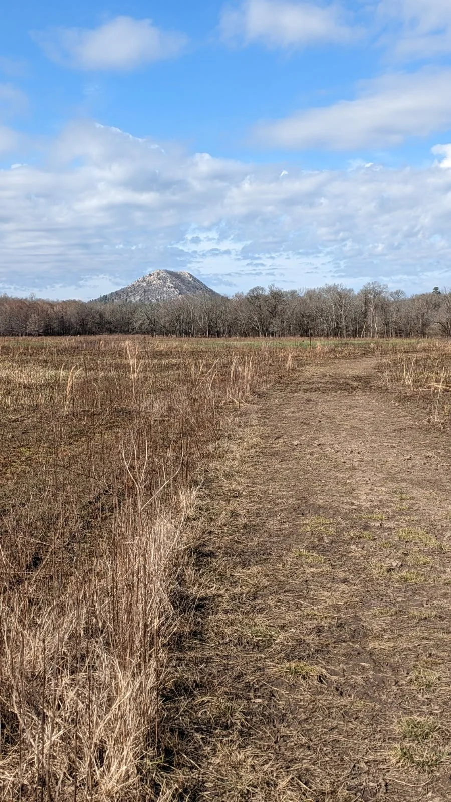
Pinnacle Mountain across the fields (January 2023)
Audubon Arkansas/Gillam Park
Distance from River Market: 3.4 miles (10 minute drive)
Trail mileage: Up to 4 miles
This spot was my inspiration to write this post. I had lived in Little Rock for several years by the time my cousin, an LR native and fellow outdoor enthusiast, took me to Gillam Park. I had never heard of it, and I bet many locals don’t even know it exists.
Since their inception and until recently, Gillam Park and the surrounding Granite Mountain neighborhood had been treated as a kind of dumping ground. The land was initially purchased by the city of Little Rock in 1934 as a place to relocate its unhoused population, and was later developed into a segregated park with the city’s first Blacks-only swimming pool. It was never well maintained and was too far out of the city to be very popular. During the era of urban renewal, Granite Mountain became the focus of the city’s efforts to force Black citizens eastward. In the 90’s, many of the community’s public housing projects were demolished, and the area became part of the Bill & Hilary Clinton National Airport’s regular flight path. Audubon Arkansas leased Gillam Park in 2005, and in 2008 opened the state’s first Audubon nature center in the former Granite Mountain community center. As recently as 2017, extant structures from the Gillam Park pool remained, but have since been removed.
Gillam Park can be reached directly by car from Gillam Park Road (off Springer Boulevard), but I prefer to start at the Audubon center and work my way down to Gillam Park via the system of trails. Audubon Arkansas is located at 4500 Springer Boulevard in Little Rock, and the trails are open sunrise to sunset every day. Park anywhere in the Audubon center’s lot and head to the right side of the building to access the trailhead.
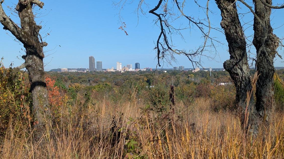
View of the downtown Little Rock skyline from Audubon’s wildlife observation trail (November 2025)
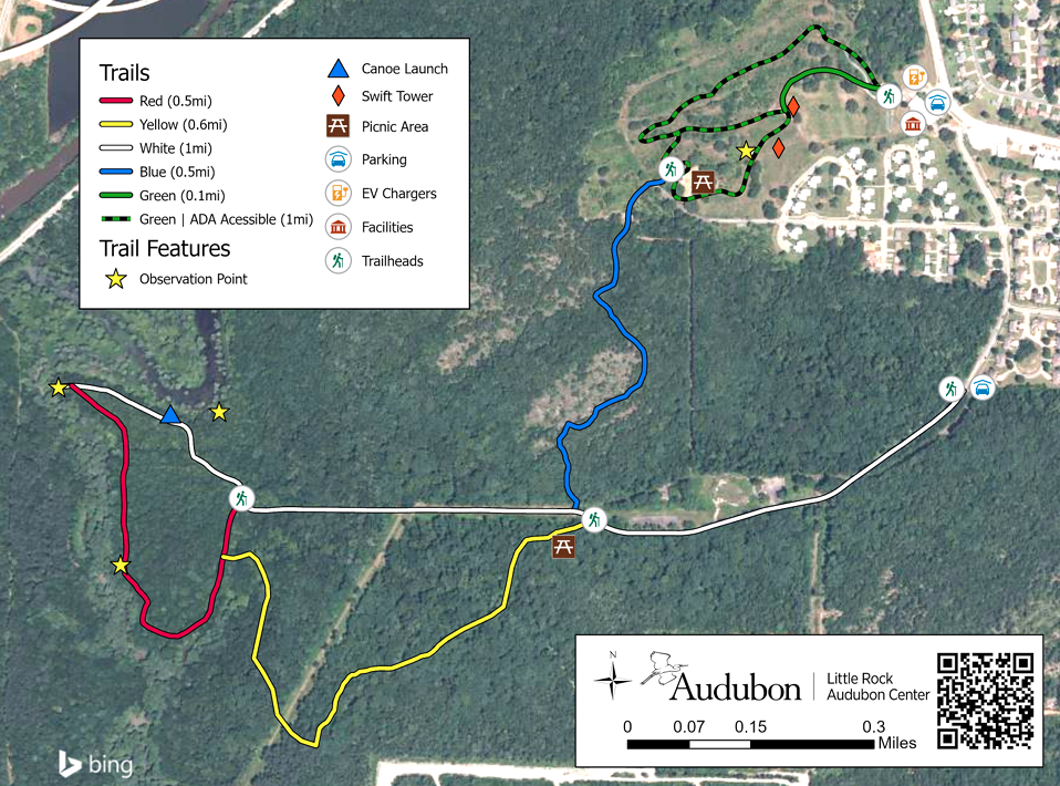
Map of Audubon and Gillam Park trails (Source: delta.audubon.org)
The 1-mile loop behind Audubon is called the “Wildlife Observation Trail.” It is paved and ADA-accessible, and offers several nice vistas of downtown Little Rock. At the far southwest corner of this loop trail is a picnic area, where the Gillam Park connector trail begins (in blue on the above map).
The trail winds its way through the woods, passing several dense stands of hickory trees that are particularly beautiful in the autumn. Of particular interest are the nepheline syenite glades here, which are apparently only found in Pulaski and Saline counties and support multiple rare species of plants and animals, like the rare small-headed pipewort. After passing the glades, the trail begins to head downhill, and eventually emerges at the main Gillam Park trail (in white on the above map).
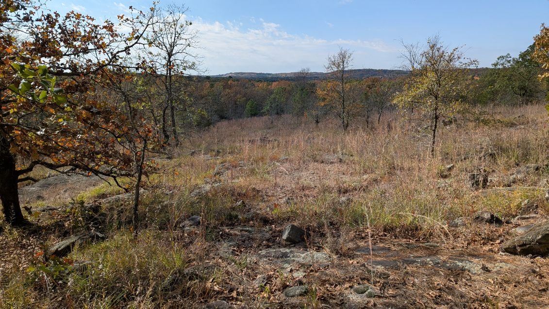
Nepheline syenite glade on the Audubon/Gillam Park connector trail (November 2025)
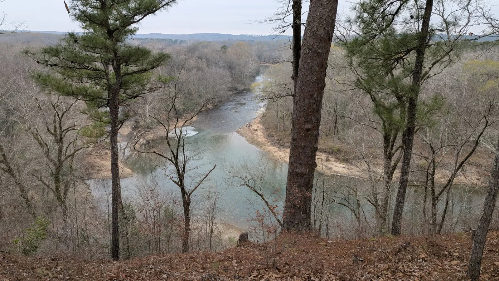
I highly recommend checking out the red trail that follows Fourche Creek. In a way it feels like a place outside time— something about the huge bald cypress trees feels very primordial. There are a few benches, a pier and a bird blind where you can stop and sit a spell. Fourche Creek drains and filters a whopping 73% of surface runoff from the city of Little Rock, and is fortunately being stewarded by Audubon and an organization called Friends of Fourche Creek. For an area that experienced nothing but abuse and neglect for years, it’s heartening to see it receive the care it deserves.
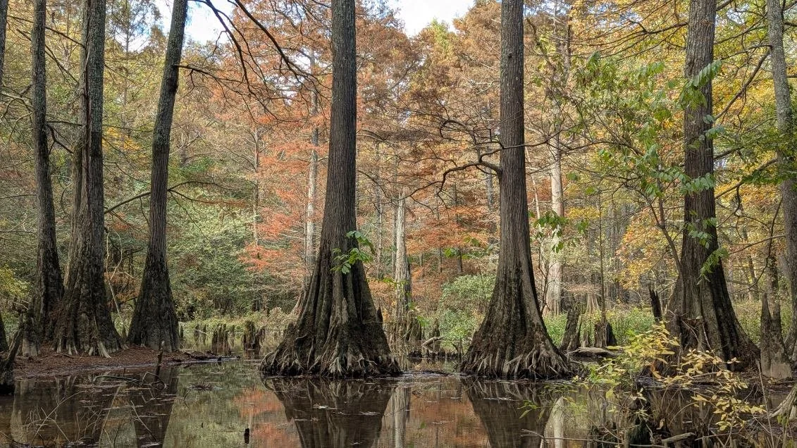
Bald cypress trees on Fourche Creek at Gillam Park (November 2025)
Once you rejoin the main Gillam Park trail, follow it back to the intersection with the connector trail, and head back the way you came. This route is about 3.5 miles in total.
** I will add that there is still a population of unhoused individuals that reside in the Granite Mountain/Gillam Park area, and it’s possible you may see some of them as you drive or hike there. These folks are just trying to exist and are not likely to bother you. As with any place, stay alert and be respectful, and you’ll be fine. Happy hiking!
Main trail at Gillam Park leading down to Fourche Creek (November 2025)